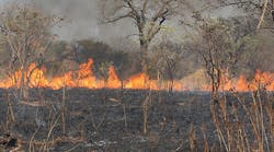
New NASA-funded satellite tools will enable firefighters to better detect fires and predict their behavior, NASA says.
The new tool, in operation at the U.S. Department of Agriculture Forest Service, uses data from the Suomi National Polar-orbiting Partnership (NPP) satellite to detect smaller fires in greater detail than previous space-based products were able to.
The high-resolution data has been used with a cutting-edge computer model to predict how a fire will change direction based on weather and land conditions.
The new product using data from Suomi NPP’s Visible Infrared Imaging Radiometer Suite (VIIRS) increases the resolution of fire observations to 1,230 feet, whereas before imagery was only available from 3,280 feet.
“The high-resolution data gleaned from VIIRS are available in a short time period and significantly enhances the Forest Service’s current strategic fire detection and monitoring capabilities,” said Brad Quayle, program lead at the USFS Remote Sensing Applications Center in Salt Lake City.
The new VIIRS 375m fire detection product was developed with support from NASA’s Earth Science Applied Sciences Program, the National Oceanic and Atmospheric Administration Joint Polar Satellite System Proving Ground Program and the U.S. Forest Service. The project team was led by Wilfrid Schroeder at the University of Maryland College Park with scientists at the National Center for Atmospheric Research.
